

Cyclone Kenneth on Thursday night made landfall in the Mozambique province of Cabo Delgado, striking the coastline with wind speeds of 220km/h. Now known as ex-Tropical Cyclone Kenneth, the storm has stalled over the country’s northern interior but still packs winds in excess of 100km/h.
The South African Weather Service (SAWS) on Friday morning issued its latest update on the storm, suggesting that there are “pockets of flooding” in the affected area.
No ad to show here.
Latest update on ex-Tropical Cyclone Kenneth. Satellite image courtesy of Eumetsat #CycloneKenneth pic.twitter.com/s4pnOAj5H8
— SA Weather Service (@SAWeatherServic) April 26, 2019
Kenneth, which formed on 21 April as Tropical Depression 14, rapidly strengthened on 24 April bringing strong wind and rain to the island chain of the Comoros. Three people have died on the island nation, according to ReliefWeb.
Devastating images from #Comoros following #CyloneKenneth.
Homes and roads are damaged and destroyed, telephone poles and trees are down. Red Crescent volunteers are supporting the urgent needs of communities, providing first aid and assessing needs on the ground. pic.twitter.com/Fl0t5C3vh1
— IFRC Africa (@IFRCAfrica) April 25, 2019
SAWS notes that the storm “will continue to weaken” through Saturday and Sunday but “heavy rain with flooding will still be possible” across northern Mozambique and southern Tanzania.
Zimbabwe’s Met Services was a little less descriptive, issuing its final update on Friday morning.
Final Update on #CycloneKenneth
Cyclone Kenneth made landfall last night in northern Mozambique and has weakened into an overland depression.
satellite image@1000hrs pic.twitter.com/feCsLjTh00— Met Services Dpt Zim (@MSDZIM) April 26, 2019
On Thursday, it noted that the storm was not likely to affect Zimbabwe, unlike Cyclone Idai.
Good morning Zimbabwe! As much as #CycloneKenneth is a reality, it is not likely to affect Zimbabwe. MSD will keep you posted on any new developments! pic.twitter.com/NxneLpJOhj
— Met Services Dpt Zim (@MSDZIM) April 25, 2019
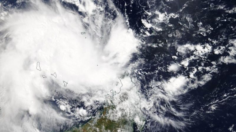
Feature image: Cyclone Kenneth on 24 April 2019, by NASA Worldview, Earth Observing System Data and Information System (EOSDIS)