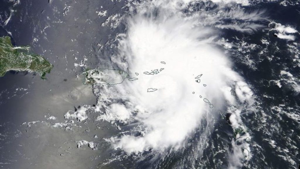
Hurricane Dorian, the fourth named storm of the 2019 Atlantic hurricane season, is bearing down on Puerto Rico tonight, and could lash Florida by the weekend.
The storm began its tropical life on 24 August when it was named Tropical Depression Five. Five then gained intensity, spending much of its life as a tropical storm, until a little more than two hours ago. It was upgraded to a Category 1 hurricane at 8pm SAST.
No ad to show here.
Hurricane Dorian now packs sustained winds of 120 km/h with gusts hitting 155 km/h. And it’s set to strengthen too. Those hurricane-force winds radiate 30 kilometres beyond the storm’s centre.
As of 2 pm #Dorian is now a hurricane located near St. Thomas in the US Virgin Islands with maximum sustained winds of 75 mph. Here is an animation of 1-minute #GOESEast visible and infrared images depicting Dorian's intensification today. pic.twitter.com/haH9GrwhOO
— NWS Eastern Region (@NWSEastern) August 28, 2019
For Puerto Rico, it’s the first hurricane to impact the island since Hurricane Maria in 2017, which led to widespread infrastructure damage and the death of more than 2000 people.
Once it clears the US territory, Dorian is setting its sights on the mainland US, according to the NOAA’s storm track predictions. Dorian could impact Florida’s eastern coastline as a Category 3 hurricane — a major storm with sustained winds in excess of 178 km/h.
Florida was last struck by a major hurricane just 10 months ago, in the form of Hurricane Michael.
Feature image: NASA Worldview/Earth Observing System Data and Information System (EOSDIS)
