

Google on Thursday revealed new updates to its SOS alert feature that will include “visual information” about natural disasters on Search and Maps.
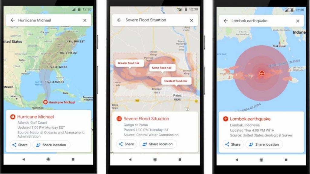
“Now, you’ll also be able to see detailed visualizations about hurricanes, earthquakes, and floods to give you a better understanding of the situation on the ground,” the company explained on its blog.
No ad to show here.
Users will be able to see “crisis cards” on Google Maps before the natural disaster takes place, and these cards will show users the weather forecast and affected areas.
The feature will also indicate how close users are to the disaster.
“After an earthquake strikes, tapping on the crisis card will display the earthquake’s shakemap—a visualization that shows you its epicenter, its magnitude, along with color coding to indicate how intense the shaking was in surrounding areas,” Google also noted.
The company will also send out navigation warnings on Maps, if users are driving near disaster zones. Maps will inform the driver with an alert and provide an alternative route.
The navigation warning feature will roll out in late 2019. The visualisations for hurricanes, and earthquakes will roll out on Android, iOS and web over the next few weeks.
“Flood forecasts visualizations will soon roll out starting in Patna, India, and then expand to the Ganges and Brahmaputra regions on Android, desktop, and mobile web,” Google also confirmed.
The features apply to regions where natural disasters often occur.
Feature image: Google