Sony launches the WF-1000XM6 in South Africa with upgraded noise cancelling, better call clarity and premium sound. Pricing starts at R7,999.
Western Cape mountains could see the first snow of the winter this week

Wondering why it’s so cold today, Cape Town? Well, we could be in for some snow on Wednesday.
A duo of cold fronts brushed past the Western Cape on Tuesday and Wednesday, bringing with them buckets of rain and potentially favourable conditions for snowfall.
According to local snow tracking website SnowReport, the tallest peaks in the Western Cape could be in for a dusting of up to 5cm on Wednesday.
“We’re seeing the possibility of up to 5cm of snow falling down to below 2000m on the Hex River Mountains, the Boland Range, the Matroosberge and in the Cederberg from Wednesday afternoon until the evening,” SnowReport wrote in its update on Tuesday.
Possible snowfall for the Western Cape from tomorrow. See the full forecast at https://t.co/YFDSIxvO9B and https://t.co/Xd0nDME3Qa pic.twitter.com/WZox3rmNdB
— Snow Report SA (@SnowReportSA) June 4, 2019
“Once the weather clears the snow may be visible from Franschhoek, Paarl, Wellington, Wolseley, Tulbagh, and from the N1 near Rawsonville, Worcester and De Doorns, as well as the Bain’s Kloof Pass.”
On Thursday, the weather will clear in the west, but eastern mountains of the Western Cape could also be in for a light dusting.
The South African Weather Service has yet to issue an update on the potential frigid weather, but it has updated its rainfall figures for the past 24 hours. The likes of Ceres received 73mm courtesy of the recent cold fronts.
The Molteno Reservoir in Cape Town’s city bowl received 40mm, while Kirstenbosch on the eastern slopes of Table Mountain received 59mm of precipitation.
24 hour rainfall amounts measured at 8AM this morning (05 June 2019). Good rainfall reported in parts of the Western Cape. pic.twitter.com/oEQkREsXBl
— SA Weather Service (@SAWeatherServic) June 5, 2019
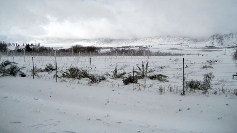
Feature image: Snow in the Western Cape in 2008, by Dplanet via Flickr (CC BY 2.0)