Sony launches the WF-1000XM6 in South Africa with upgraded noise cancelling, better call clarity and premium sound. Pricing starts at R7,999.
Google Maps now shows the Earth as a globe

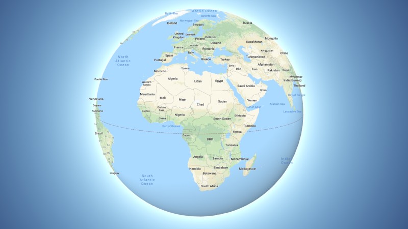
Google has likely offended scores of flatearthers this past week after the company added a new update to Maps that displays planet Earth as a globe.
Previously the app displayed the planet much like a massive map on its Maps interface. Now, when users zoom out, they’ll be greeted by a bulbous ball in space.
Why the change? For Google, it believes that it’s a better way to represent relative sizes of countries and continents.
While Greenland may look the same size as Africa on a flat map, on a globe, its much smaller.
Thank you for showing the real size of Africa. pic.twitter.com/rhmYYM8DN7
— Michael (@Ronsoco67) August 6, 2018
Users didn’t quite understand the tweak though, wondering why Google only made the move on desktop and not mobile, or why the company sacrificed UI in favour of usability.
Wish this was an option. It is harder to see larger distances at a responsible magnification. Example: looking at sailing routes across the Atlantic.
— Matt Hilleman (@MattHilleman) August 5, 2018
The change should be live for all users on the desktop version of Maps.
Feature image: Google Maps


