With powerful hardware working together with an industry-leading camera system and intuitive AI experiences, everyday tasks have never been easier and faster
An intense ‘medicane’ is posing a threat to southern Europe

After Florence and Mangkhut, do you need any more proof that the weather is all sorts of crazy this year? If you answered yes, we may have just the thing.
Actually, no, more specifically, it’s the Mediterranean Sea that has the answer.
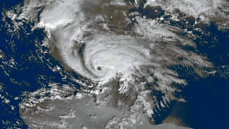
A “medicane” is at present forming in the massive body of water that separates north Africa from southern Europe.
Although bearing similar nomenclature to “hurricanes” which form in the Atlantic Ocean, medicanes are cyclonic storms that form within the confines of the Med.
They’re not as intense and don’t live as long, but they can pack a punch. And their satellite images of this week’s example are no less terrifying.
Models are in very good agreement in potentially intense warm core cyclone *MEDICANE* in the Ionian sea this Friday. The Medicane could make landfall in SW Greece early Sunday with extremely severe winds, high waves, torrential rainfall & flash floods: https://t.co/WsGna2s3Vs pic.twitter.com/1VDeTuqjiF
— severe-weather.EU (@severeweatherEU) September 25, 2018
This particular storm, which will be called Zorbas, poses a threat to southern Italy, Crete and the Greek Islands heading into Friday. Forecasts include heavy rain for regions around the Adriatic and eastern Europe.
And if that isn’t enough, peak wind speed is set to approach that of a category 1 equivalent hurricane, around 150km/h.
Long sea track for #Medicane #Zorbas squeezing north of Crete and into the Aegean Sea. Arpege has this cyclone as an equvalent category 1 hurricane at peak intensity –> https://t.co/463xhlg4eG pic.twitter.com/pmfBngiE2O
— wxcharts (@wxcharts) September 27, 2018
The medicane is set to linger in the Med for much of Friday, moving northeast through Sunday when it will eventually dissipate.
Feature image: Wikimedia


