Sony launches the WF-1000XM6 in South Africa with upgraded noise cancelling, better call clarity and premium sound. Pricing starts at R7,999.
Google Maps’ new updates makes commuting across your city much easier

Google Maps is this week getting another update, specifically for people who travel across their city.
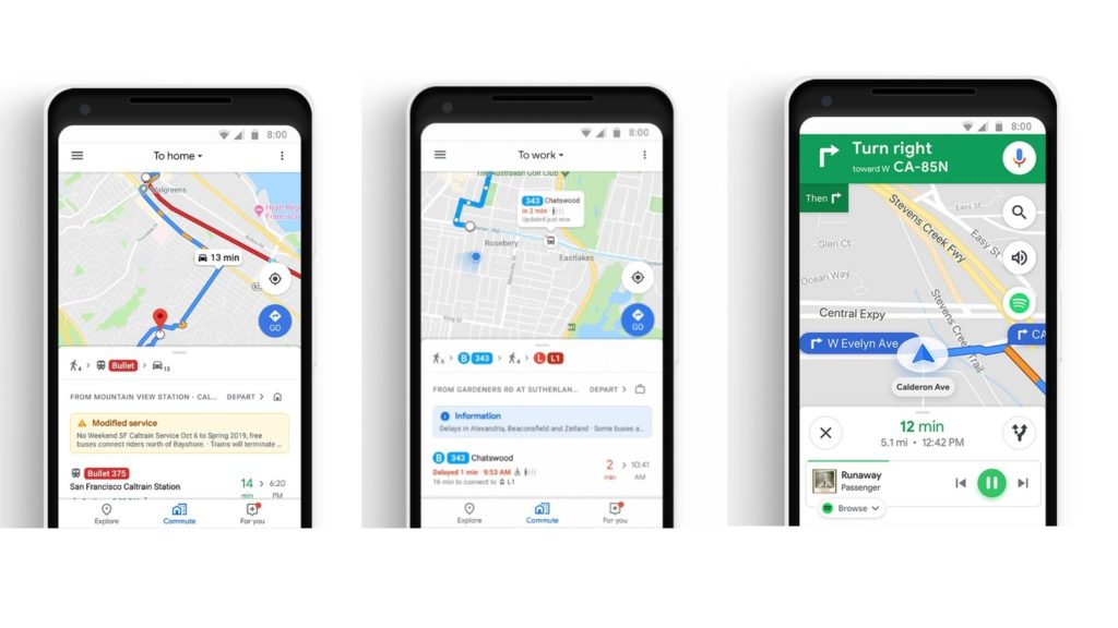
The app will now feature a new “Commute” tab on the lower navigation menu, which “provides one-tap access to live traffic and transit information tailored to your commute”.
Said tailored info includes the average journey duration along your normal route, route deviations if there are obstructions, and notifications if there are disruptions to your normal commute.
Google Maps doesn’t just cater for drivers though. The company revealed that public transit modes are now also supported.
“You can see helpful information about when to leave, and for each leg of your trip: you’ll know if there’s traffic on your drive, when the next train departs, and how long it’ll take to walk from the train station to the office,” Google added.
Finally, in a move that makes South Africa’s public transport system look even worse than it does already, more than 80 other regions will feature granular bus and train transit info.
Users will be able to track the position of their train or bus in realtime. And this is just the tip of the iceberg. In Sydney, Google’s partnering with Transport New South Wales to “show how full you next bus or train is – so you’ll know whether or not you’ll get a seat”.
Google Maps is also set to receive a UI change for music lovers. Those riding shotgun will be able to change tunes from Spotify, Apple Music, and Google Play Music directly from Maps’ interface.
These tweaks will be added to the Android and iOS versions of Google Maps globally this week.
The service’s latest update comes just four days after its group planning feature was announced, allowing a group of friends to collaboratively plan outings through Maps.
Feature image: Google Maps


