With powerful hardware working together with an industry-leading camera system and intuitive AI experiences, everyday tasks have never been easier and faster
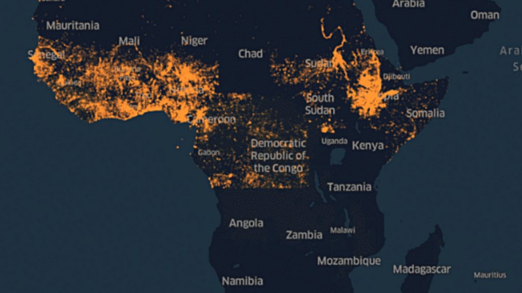
Facebook is using AI to create population density maps of Africa

Facebook on Tuesday revealed its own efforts to support humanitarian work across Africa through the use of machine learning.
“Facebook is working closely with key non-profit and research partners to use artificial intelligence (AI) and big data to address large-scale social, health and infrastructure challenges in sub Saharan Africa,” a press release stated.
A mapping project initiated by the company has been using AI to create population density maps of the continent, which help determine where the largest concentrations of communities can be found.
This, in turn, allows humanitarians to easily find the societies they need to assist in otherwise remote parts of the world.
“The maps from Facebook ensure we focus our volunteers’ time and resources on the places they’re most needed, improving the efficacy of our programs,” said the director of humanitarian for OpenStreetMap, Tyler Radford.
To create these maps, Facebook uses its AI technology along with “satellite imagery from Digital Globe with public census data”.
According to the company, data and personal information from Facebook users are not part of its mapping project.
The company plans to develop population density maps for more parts of the world in the future.
Feature image: supplied, Facebook