Sony launches the WF-1000XM6 in South Africa with upgraded noise cancelling, better call clarity and premium sound. Pricing starts at R7,999.
Google Earth introduces Timelapse – Here’s how to use it

Google Earth no longer just explores space on our planet, it also explores time with the help of a new feature called Timelapse.
The feature was announced on 15 April.
Timelapse is Google Earth’s biggest update since 2017. It allows users to view how Earth has transformed over the last 37 years.
“With Timelapse in Google Earth, we have a clearer picture of our changing planet right at our fingertips — one that shows not just problems but also solutions, as well as mesmerizingly beautiful natural phenomena that unfold over decades,” Google Earth’s director of Earth Engine and Outreach, Rebecca Moore, said in a blog post.
How Google’s Earth Timelapse was created
To create Timelapse, Google used its cloud platform Earth Engine to conduct geospatial analysis. The feature is one big video that uses 24 million satellite images taken between 1984 and 2020.
The photos were sourced from NASA, the US Geological Survey’s Landsat program, and the EU’s Copernicus observation program.
The video took more than two million processing hours to create and contains 4.4. trillion pixels. To put that into perspective, the video is the equivalent of 530 000 videos in 4K resolution.
Google said it will continue to update the feature with new Timelapse imagery every year over the next decade.
To promote the feature, Google published a video on YouTube demonstrating Timelapse.
You can check out the video below:
How to watch Timelapse on Google Earth
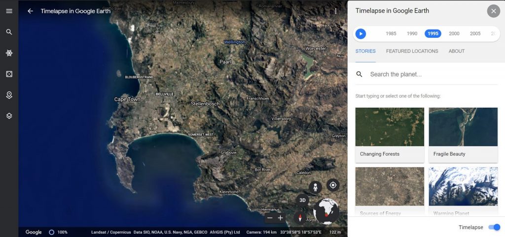
To watch TimeLapse, go to Google Earth and select the ships wheel icon on the left-hand side.
The feature comes with several interactive guided tours based on specific themes. They include Changing Forests, Urban Expansion, Fragile Beauty, and Warming Planet.
Alternatively, use the search bar to find a specific place.

You can watch Timelapse in both 2D and 3D.
In addition, Google uploaded more than 800 2D and 3D videos for public use.
The videos are available on the Google Earth website and users can download them in MP4 format. You can also watch the videos on YouTube.
Feature image: Unsplash/NASA


