AI is disrupting education. But despite what the headlines (and some ChatGPT horror stories) might suggest, South African teachers aren’t being replaced — they’re…
WATCH: Get a birds eye view of your route with Google immersive view
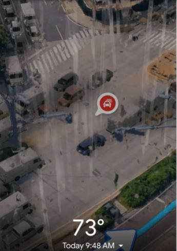
Get a birds eye view of your trip, before you leave for your destination.
This is exactly what Google Maps has in store as it introduces AI to provide immersive views for routes in the upcoming updates for Google maps.
Google Maps has officially reimagined how users will navigate to their destinations with the incoming immersive view feature.
Think a virtual birds eye view of your route like you’re really there.
Google Maps, with the advancement of AI is updating how users will understand their maps before a journey.
@tomsguide Google Maps Immersive View looks awesome! #googlemaps #google #googleio #googleio2023 #maps #android #androidapps #googlenews #androidvsios #nyc #city #bikeroute #technews #ai
Preview your journey
Coupled with AI, Google plans to reinvent maps and make it more visual with features such as Live View and Immersive View of places.
With Immersive View, users will get to visualize every segment of their route before they start navigating.
Driving or walking the feature will allow users to fuse together aerial images to create a rich outlay of the world and the journey users plan to travel.
“With this technology, you can see all the information you need about your route at once. When you get directions, you’ll see a multidimensional experience that lets you preview bike lanes, sidewalks, intersections and parking along your journey,” Google said announcing the feature.
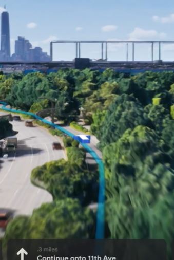
“With the time slider, you’ll see air quality information and how the route looks as the weather changes throughout the day, so you can be prepared with a jacket or sunscreen. And no matter what mode you take, AI and historical driving trends simulate how many cars might be on the road at a given time — because a route during a quiet afternoon can look very different during rush hour.
Time and journey
With immersive view, users will get to not only get their travel directions from maps but will soon be able to predict the weather.
Google is also paving the way for developers
“With our new Aerial View API, available today in preview, developers can easily integrate a 3D birds-eye video of a point of interest into their apps, offering people more visual information about a place.
“Rent. is already using the Aerial View API to help renters visualize a property and its surrounding area so they can explore a neighborhood virtually and make more informed decisions about where to live”
Think of it as the Kruger National Park creating a 3-dimensional map of the park with realistic images of bushveld, trees, and game to entice travelers to visit.
Users will be able to develop an interactive map tour of architectural landmarks in a virtual guided tour for tourists to get a real sense of what is in store for their journey.
Also read: Dubai launch: Huawei launches Huawei P60 Pro and its definitely unique