HONOR has officially opened pre-orders for its much-anticipated HONOR 400 and HONOR 400 Pro smartphones in South Africa — ushering in a bold new…
How to see COVID-19 information in Google Maps

In September, Google announced that it would add COVID-19 information to Google Maps to give users visual information on the latest data for their country.
Unlike some other features, Google’s COVID-19 info in Maps is available for all 220 countries and territories that the service supports.
For many regions, there is also state, province, county, and city-level data.
The data comes from multiple sources, including Johns Hopkins University, the World Health Organisation, and local health agencies.
The feature is available worldwide on Android and iOS.
How to see COVID-19 info in Google Maps
So how can you view the local information for COVID-19 using the Google Maps app?
You will need to make sure you have the latest version of the app installed.
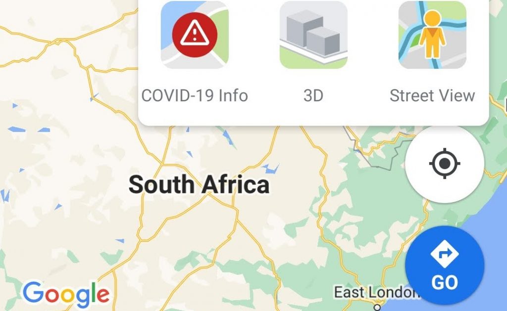
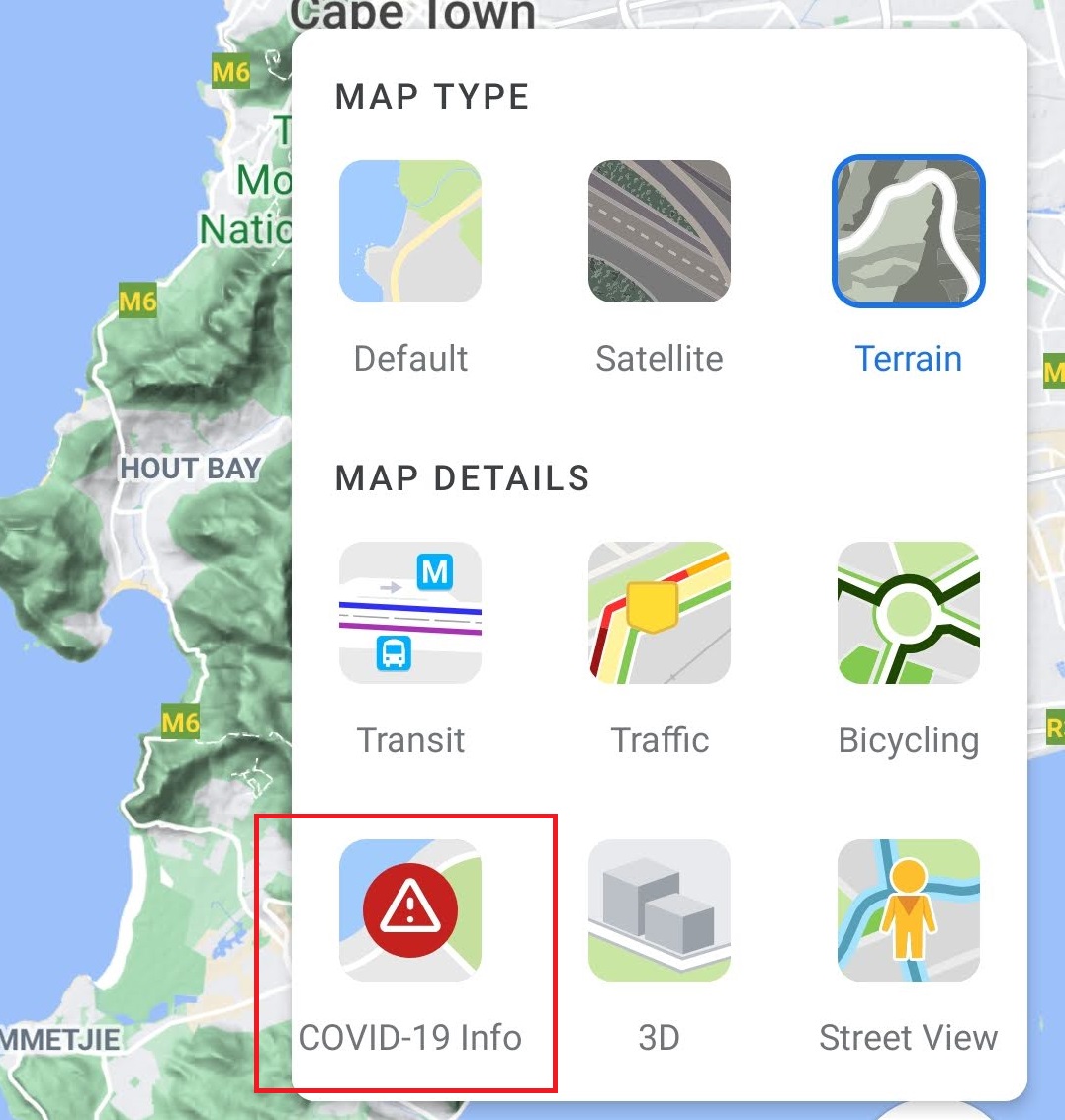
To view the map with the COVID-19 overlay, select the icon with two squares floating over each other.
![]()
You can then switch to the COVID-19 map overlay view.
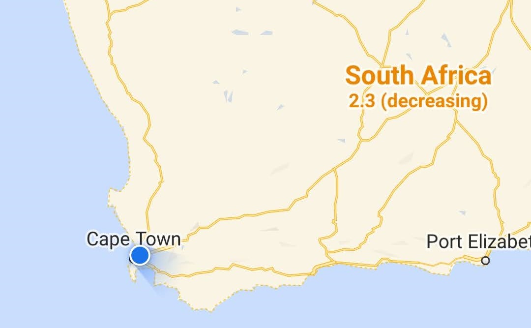
At the time of writing, only the national view is available for South Africa. It provides a number for the country, which represents new cases per 100 000 people.
It also shows you whether rates are increasing or decreasing.
However, regional views are available for other territories. For example, you can view the United Kingdom as a whole, along with individual countries within the UK.
Meanwhile, for the Republic of Ireland, you can view cities such as Dublin, as well as certain counties.
While the tool is by no means comprehensive, it provides a quick snapshot of new case rates for your country.
Feature image: Screenshot/Google Maps
Read more: Get your COVID-19 facts straight with these online resources